

Dangerous Ice Storm Warning In Effect For Iowa and Illinois
If you were dreaming of a white Christmas the closest thing you are going to get today in Iowa and Illinois is a clear Christmas. This is causing dangerous travel conditions across the area.
An Ice Storm Warning is in effect for a large portion of Iowa and extending into Illinois.
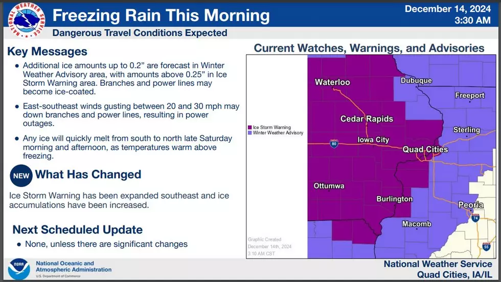
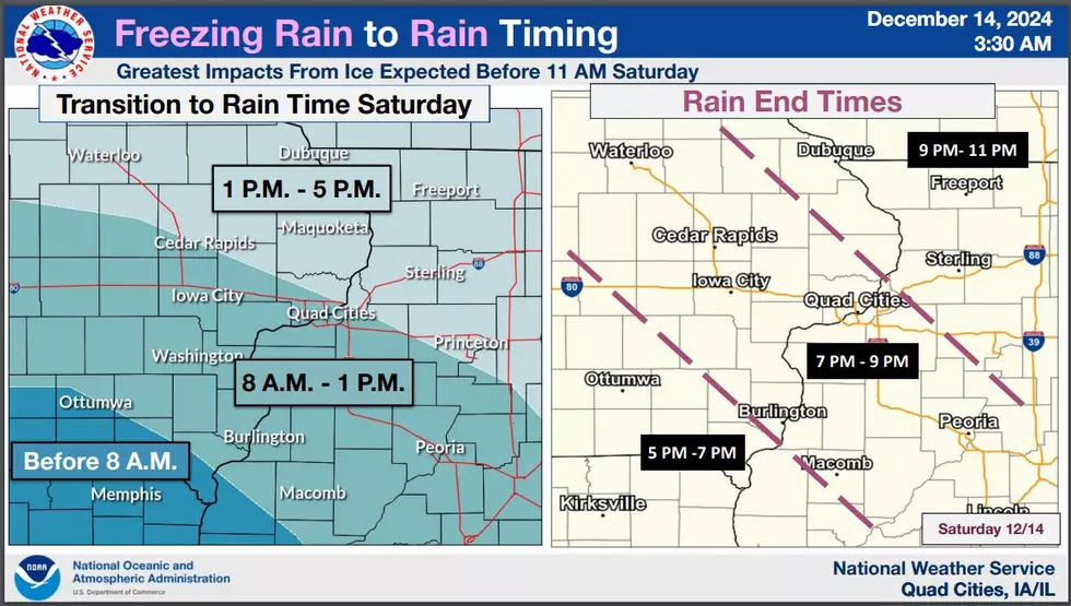
The ice storm warning has been extended and is now in effect till 4:00 p.m. on Saturday, December 14.

Additional ice accumulations between two-tenths and three-tenths of an inch. Winds gusting as high as 30 mph.
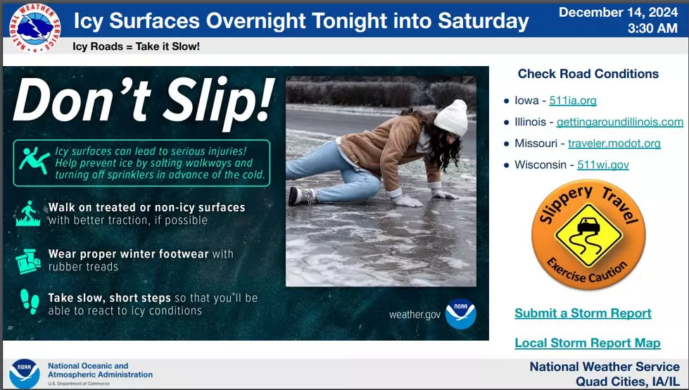
Power outages and tree damage are likely due to the ice. Travel could be nearly impossible.

Travel is strongly discouraged. If you must travel, keep an extra flashlight, food, and water in your vehicle in case of an emergency. Prepare for possible power outages. the latest road conditions are available at ia511.org or by calling 511.

As we head into the evening hours, lingering moisture with the ongoing storm system should maintain some precipitation across our area. However, this should decrease with time as the mid-level shortwave and attendant surface low move off to the east. With the warmer air mass in place tonight, any precipitation should be in the form of regular rain instead of freezing rain.

Additionally, with a moist boundary layer in the wake of the rainfall, some areas of fog appear more likely tonight into Sunday morning.
Get more updates from the National Weather Service.
LOOK: The most expensive weather and climate disasters in recent decades
Gallery Credit: KATELYN LEBOFF
More From Quad Cities Sports Network

